

From the Open-Publishing Calendar
From the Open-Publishing Newswire
Indybay Feature
California
Santa Cruz Indymedia
Environment & Forest Defense
Government & Elections
Health, Housing & Public Services
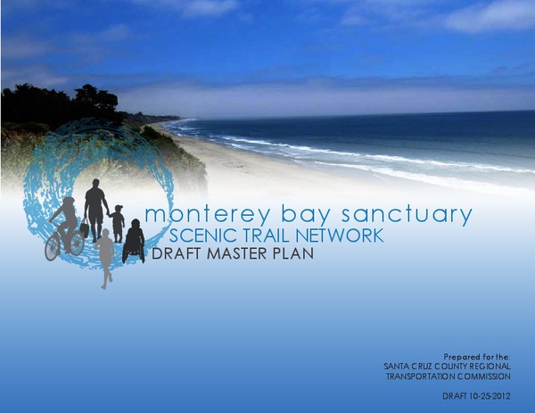
Monterey Bay Sanctuary Scenic Trail: Draft Master Plan Comment Period Opens
The Draft Master Plan for the Monterey Bay Sanctuary Scenic Trail Network is now available for public review. The purpose of the Draft Master Plan is to establish the continuous alignment and set of design standards for the Monterey Bay Sanctuary Scenic Trail Network, including the Coastal Rail Trail spine, and associated spur trails. Planning for the Trail Network is done within the context of existing physical constraints of the railroad, potential rail service, coastal access requirements, highway, and public street rights-of-way. The Draft Master Plan identifies planning issues associated with the trail’s construction and presents possible solutions for its design, implementation, long term operation and maintenance.
The MBSST Draft Master Plan was released for public review and comment on October 25, 2012. Written comments on the document will be received until December 21, 2012 at info [at] sccrtc.org
The MBSST Draft Master Plan was released for public review and comment on October 25, 2012. Written comments on the document will be received until December 21, 2012 at info [at] sccrtc.org
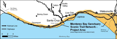
Monterey Bay Sanctuary Scenic Trail Network
Have you been waiting for the “rail trail” or “coastal trail” project? Planning for a new multi-use bicycle and pedestrian trail network is in full swing.
Project Scope
The Regional Transportation Commission (RTC) is currently planning for the Monterey Bay Sanctuary Scenic Trail Network (Trail Network). This project merges plans for a bicycle/pedestrian trail along the rail line – including coastal alignments and neighborhood spurs – into a connected network that will overlap and converge to provide safe and convenient route choices. The trail will serve transportation, recreation and interpretive uses for walkers, joggers, bicyclists, families, locals, and visitors.
Upcoming Public Input Opportunities
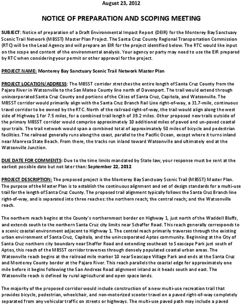
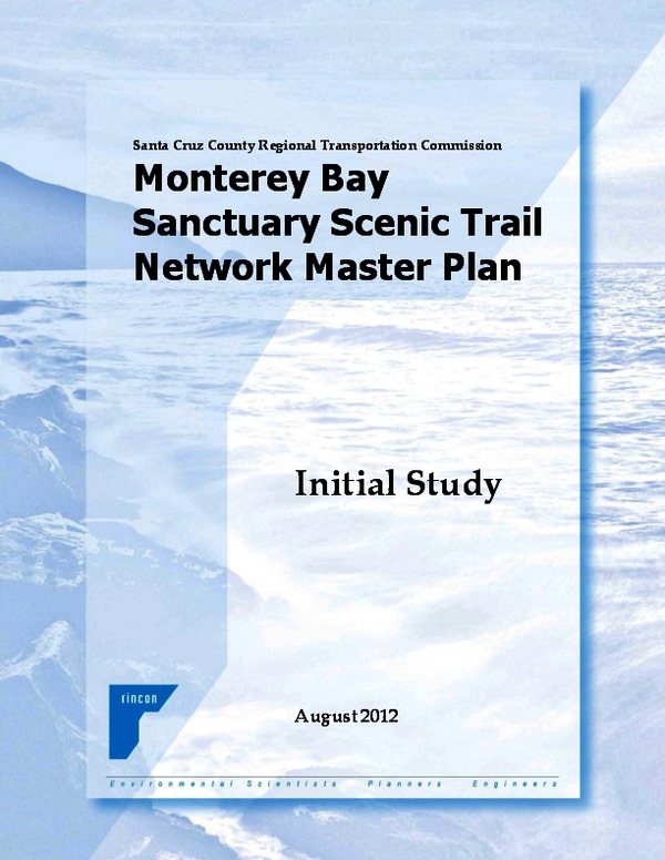
The RTC released a Notice of Preparation and Initial Study for the Draft Environmental Impact Report (EIR) in late August. The RTC is receiving input on the content and focus of the environmental analysis to be conducted and presented in the Draft EIR until November 30, 2012. A Draft Trail Network Master Plan was released in late October 2012 with recommendations for design standards, prioritization of projects, implementation mechanisms and ongoing maintenance. Public workshops are scheduled for November to gather community input on the Draft Master Plan.
Activities Completed To Date
Corridor tours
Identification and mapping of opportunities and constraints
Stakeholder meetings with over 50 agencies, community representatives and businesses
Three route identification public workshops with over 200 members of the public
Public Draft Environmental Impact Report Scoping Meetings
Background
The broad vision is for a Trail Network project that will span the coast of the Monterey Bay National Marine Sanctuary from the San Mateo/Santa Cruz County line to Pacific Grove, in Monterey County. The RTC is leading the planning effort for project development in Santa Cruz County and the Transportation Agency for Monterey County (TAMC) is responsible for Monterey County projects. This approach will ensure that the planned bicycle/pedestrian network will provide connectivity throughout the county and into the Monterey Bay region, as well as tie in the larger California Coastal Trail and Pacific Coast Bicycle Trails.
Funding
Approximately $7 million of local and federal funds have already been secured for construction of initial segments. Congressman Sam Farr is the project’s most passionate champion and has secured millions of federal dollars for construction of this two-county path. The RTC committed locally controlled funds to bring this project to fruition, as did the California Coastal Conservancy.
Draft Master Plan
The Draft Trail Network Master Plan is now available for review. Please provide comments in writing no later than Dec. 21, 2012 to info [at] sccrtc.org
Public Workshops on the Draft Master Plan
Monday, November 26, 2012: Community Foundation of Santa Cruz, Aptos(6-8pm)
Tuesday, November 27, 2012:Pacific Elementary School, Davenport (6-8pm)
Wednesday, November 28, 2012: Simpkins Family Swim Center, Live Oak (6-8pm)
Thursday, November 29, 2012: Civic Plaza Community Room, Watsonville (6-8pm)
Santa Cruz County Regional Transportation Commission (SCCRTC)
http://sccrtc.org/
RTC Contact
Cory Caletti
Senior Transportation Planner/Project Manager
info [at] sccrtc.org
460-3200
Have you been waiting for the “rail trail” or “coastal trail” project? Planning for a new multi-use bicycle and pedestrian trail network is in full swing.
Project Scope
The Regional Transportation Commission (RTC) is currently planning for the Monterey Bay Sanctuary Scenic Trail Network (Trail Network). This project merges plans for a bicycle/pedestrian trail along the rail line – including coastal alignments and neighborhood spurs – into a connected network that will overlap and converge to provide safe and convenient route choices. The trail will serve transportation, recreation and interpretive uses for walkers, joggers, bicyclists, families, locals, and visitors.
Upcoming Public Input Opportunities
The RTC released a Notice of Preparation and Initial Study for the Draft Environmental Impact Report (EIR) in late August. The RTC is receiving input on the content and focus of the environmental analysis to be conducted and presented in the Draft EIR until November 30, 2012. A Draft Trail Network Master Plan was released in late October 2012 with recommendations for design standards, prioritization of projects, implementation mechanisms and ongoing maintenance. Public workshops are scheduled for November to gather community input on the Draft Master Plan.
Activities Completed To Date
Corridor tours
Identification and mapping of opportunities and constraints
Stakeholder meetings with over 50 agencies, community representatives and businesses
Three route identification public workshops with over 200 members of the public
Public Draft Environmental Impact Report Scoping Meetings
Background
The broad vision is for a Trail Network project that will span the coast of the Monterey Bay National Marine Sanctuary from the San Mateo/Santa Cruz County line to Pacific Grove, in Monterey County. The RTC is leading the planning effort for project development in Santa Cruz County and the Transportation Agency for Monterey County (TAMC) is responsible for Monterey County projects. This approach will ensure that the planned bicycle/pedestrian network will provide connectivity throughout the county and into the Monterey Bay region, as well as tie in the larger California Coastal Trail and Pacific Coast Bicycle Trails.
Funding
Approximately $7 million of local and federal funds have already been secured for construction of initial segments. Congressman Sam Farr is the project’s most passionate champion and has secured millions of federal dollars for construction of this two-county path. The RTC committed locally controlled funds to bring this project to fruition, as did the California Coastal Conservancy.
Draft Master Plan
The Draft Trail Network Master Plan is now available for review. Please provide comments in writing no later than Dec. 21, 2012 to info [at] sccrtc.org
Public Workshops on the Draft Master Plan
Monday, November 26, 2012: Community Foundation of Santa Cruz, Aptos(6-8pm)
Tuesday, November 27, 2012:Pacific Elementary School, Davenport (6-8pm)
Wednesday, November 28, 2012: Simpkins Family Swim Center, Live Oak (6-8pm)
Thursday, November 29, 2012: Civic Plaza Community Room, Watsonville (6-8pm)
Santa Cruz County Regional Transportation Commission (SCCRTC)
http://sccrtc.org/
RTC Contact
Cory Caletti
Senior Transportation Planner/Project Manager
info [at] sccrtc.org
460-3200
Add Your Comments
We are 100% volunteer and depend on your participation to sustain our efforts!
Donate

$240.00 donated
in the past month
Get Involved
If you'd like to help with maintaining or developing the website, contact us.
Publish
Publish your stories and upcoming events on Indybay.
Topics
More
Search Indybay's Archives
Advanced Search
►
▼
IMC Network