

From the Open-Publishing Calendar
From the Open-Publishing Newswire
Indybay Feature
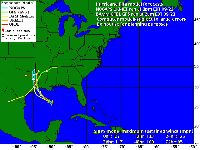
Updates On Rita:
Forecasts and updates as Rita approaches
Rita is completing its eyewall replacement cycle this morning...as
the last report from an Air Force Reserve hurricane hunter aircraft
showed that the inner 15 N mi wide eye had dissipated and a single
33 N mi wide eye existed. Maximum flight-level winds at 700 mb in
the northeastern quadrant are 125-130 kt...which helps support an
initial intensity of 120 kt. The aircraft data showed that another
wind maxima has formed about 60 N mi from the center...which might
be the start of another outer eyewall. The latest central pressure
reported by the aircraft is 927 mb.
Rita is moving between 300-305 degrees at 8-9 kt. Rawinsonde data
at 00z indicates that the mid-level ridge is still present over
Texas. This feature should move eastward during the next 24-48
hr...allowing the current northwestward motion to become more
northerly. Track guidance is now clustered about a landfall on the
Upper Texas coast in roughly 30 hr...with the model track being
spread between San Luis Pass and Sabine Pass. The forecast track
up to landfall is essentially an update of the previous package.
After landfall...the guidance become very divergent as high
pressure build to the west and possibly north of Rita. Given the
spread...the forecast track will call for little motion after 72 hr
just as the previous forecast did. This stalling will pose a
serious risk of very heavy rainfall well inland.
The intensity forecast is still problematic. Since Rita has
completed the eyewall replacement cycle and is over the warm eddy
of The Loop current...there is a chance it could strengthen during
the next 12 hr. After that...it should moved north of the eddy...
possibly start another eyewall cycle...and possibly experience
increasing southerly shear. The intensity forecast thus calls for
a slight increase in strength in 12 hr...follwed by slight
weakening. An alternative scenario is that Rita does not
strengthen...and gradually weakens due to shear until landfall.
This could happen if the shear reaches the 25 kt values forecast by
the GFS and SHIPS models.
Forecaster Beven
http://weather.wwltv.com/auto/wwltv/tropical/at200518.disc.html
We are 100% volunteer and depend on your participation to sustain our efforts!
Donate

$120.00 donated
in the past month
Get Involved
If you'd like to help with maintaining or developing the website, contact us.
Publish
Publish your stories and upcoming events on Indybay.
Topics
More
Search Indybay's Archives
Advanced Search
►
▼
IMC Network
the weakening trend appears to have leveled off. It appears that the
eyewall replacement cycles have been the dominant factor...as
usual...in controlling the intensity fluctuations of Rita. Flight
level wind data from the reconnaissance aircraft indicate that
maximum winds are about 110 knots. Objective T-numbers have
increased a little suggesting stronger winds but I rather wait for
these numbers to persist. Only a slight weakening is forecast
before landfall due to shear and cooler ocean. This is not a very
significant change and in fact...Rita is still forecast to make
landfall as a category three hurricane.
The hurricane has been moving toward the northwest or 320 degrees at
about 10 knots during the past few hours. No significant change in
the steering pattern is expected before landfall. On this
track...the core of Rita should reach the Upper Texas/southwest
Louisiana coast Saturday morning. Thereafter...the steering
currents are foreast to collapse and a weakened Rita could
meander for a few days over northeast Texas/southwest Arkansas
producing torrential rains.
...Correction to warnings west of High Island Texas...
...Rita moves farther inland...weakens to a category two
hurricane...
At 7 am CDT...1200z...the Hurricane Warning and Tropical Storm
Warning west of High Island Texas have been discontinued.
A Hurricane Warning remains in effect from High Island to Morgan
City Louisiana.
A Tropical Storm Warning remains in effect for the southeastern
coast of Louisiana east of Morgan City to the mouth of the Pearl
River...including metropolitan New Orleans and Lake Pontchartrain.
For storm information specific to your area...including possible
inland watches and warnings...please monitor products issued
by your local weather office.
At 7 am CDT...1200z...the center of Hurricane Rita was located near
latitude 30.4 north...longitude 94.2 West....Midway between Jasper
and Beaumont Texas.
Rita is moving toward the northwest near 12 mph. A gradual turn
toward the north and a decrease in forward motion is expected
during the next 24 hours. This motion should bring the center of
Rita farther inland over southeastern Texas today.
Maximum sustained winds have decreased to near 100 mph...with higher
gusts. This makes Rita a category two hurricane on the
Saffir-Simpson scale. Additional weakening is expected today as
the center moves farther inland.
Hurricane force winds extend outward up to 85 miles from the
center...and tropical storm force winds extend outward up
to 205 miles. A ham radio report indicates that Jasper Texas
measured a wind gust to 85 mph recently.
Estimated minimum central pressure is 950 mb...28.05 inches.
Coastal storm surge flooding of 15 feet above normal tide levels...
locally up to 20 feet at head of bays and nearby rivers...with
large and dangerous battering waves...were probably experienced
to the east of where the center made landfall. The coastal storm
flooding should begin to slowly subside today. Tides along the
southeast Louisiana and Mississippi coasts in areas affected by
Katrina could be 4 to 6 feet above normal and be accompanied by
large waves... and residents there are experiencing coastal
flooding. Large swells generated by Rita will likely continue to
affect most portions of the Gulf Coast.
Since Rita is movingly slowly and is forecast to slow down further
over the next few days...rainfall totals of 10 to 15 inches are
expected over eastern Texas and western Louisiana. Maximum
rainfall totals in excess of 25 inches may occur over localized
areas. Rainfall amounts of 3 to 5 inches with isolated heavier
amounts are possible over southeastern Louisiana including
metropolitan New Orleans.
Isolated tornadoes are possible today and tonight over far eastern
Texas...Louisiana...southern Arkansas...and Mississippi.
Repeating the 7 am CDT position...30.4 N... 94.2 W. Movement
toward...northwest near 12 mph. Maximum sustained winds...100 mph.
Minimum central pressure... 950 mb.
The next advisory will be issued by the National Hurricane Center at
10 am CDT.
http://weather.wwltv.com/auto/wwltv/tropical/at200518.public.html
(CNN) -- Here are the latest numbers as reported by the National Hurricane Center at 8 a.m. EDT:
Top wind speed:
-- near 100 mph, with higher gusts. Gradual weakening is expected now that Rita has made landfall.
Saffir-Simpson scale status:
--Category 2 (winds 96 mph -110 mph)
Location of storm center:
-- Midway between Jasper and Beaumont, Texas.
Movement:
-- Northwest at near 12 mph. Rita is expected to make a gradual turn toward the north and forward motion should slow down over the next 24 hours, moving the center further inland over southeastern Texas on Saturday.
Watches and Warnings:
-- Hurricane warning in effect from High Island, Texas (south of Houston) to Morgan City, La. An earlier warning west of High Island, Texas was canceled.
-- Tropical storm warning issued for southeastern coast of Louisiana east of Morgan City to the mouth of the Pearl River, including metropolitan New Orleans and Lake Pontchartrain, and from south of Sargent, Texas, to Port O'Connor, Texas. An earlier warning from Port O'Connor to Port Aransas was canceled.
-- Isolated tornadoes possible through Saturday night in portions of Louisiana, Texas, Arkansas and Mississippi. Tornado warnings already posted in Louisiana.
Size of storm:
-- Hurricane-force winds extend up to 85 miles from the center, and tropical storm-force winds extend up to 205 miles. Hurricane-force winds are expected to spread inland as far as 100 miles near the path of Rita. A wind gust of 85 mph was reported recently in Jasper, Texas.
Storm surge:
-- Coastal storm surge flooding of 15 feet above normal tide levels, possibly up to 20 feet at head of bays and nearby rivers, along with dangerous, battering waves near and to the east of where Rita makes landfall. The National Hurricane Center says the storm surge will not recede until the winds abate later Saturday.
-- Tides are currently running about 2 feet above normal along the Louisiana, Mississippi and Alabama coasts in areas affected by Hurricane Katrina. Tides in those areas will increase 4 to 6 feet, and be accompanied by large waves.
-- "Large swells generated by Rita will likely affect most portions of the Gulf Coast."
Rainfall:
-- Rita is expected to slow down during the next few days. Rainfall totals of 10-15 inches are expected over eastern Texas and western Louisiana. Maximum rainfall totals in excess of 25 inches could occur over localized areas. Rainfall amounts of 3-5 inches with isolated heavier totals are possible over southeastern Louisiana, including metropolitan New Orleans. (Posted: 8:25 a.m.)
More
http://www.cnn.com/2005/US/09/24/news.update.sat/