

9/11 Truth Festival presents the case for an "unimpeachable" investigation into 9/11
The event opened with a commemorative to the victims of 9/11 called "Remembrance" by Janette MacKinley, a 9/11 survivor, mother and artist whose condo was directly across from the twin towers when they were hit. MacKinley related her experience of the events of that day and emphasized the need to heal from the psychological trauma of America's own "Shock and Awe" event. MacKinley, with her friend and art collaborator Nicholas Sikelianos, brought on stage a five-foot bamboo representation of the twin towers in which Janette did a live presentation of the Japanese flower-arranging art of Ikebana, weaving green and red bamboo shafts connecting the two towers together.
Films shown at the festival were "Hijacking Catastrophe: 9/11, Fear & the Selling of American Empire" which examines how a radical fringe in the government has used the trauma in the terrorist attacks of 9/11 to advance a pre-existing agenda; "9/11 Press for Truth" which documents the "Jersey Girls" call for a 9/11 investigation and their betrayal by the 9/11 Commission; "We Were Also Killed on 9/11: First Responders" featuring firemen and other 9/11 first responders and the serious health problems they are experience due to their exposure to the dust on the pile; "'Hasta La Victoria Siempre!' with William Pepper," which presents an international human rights lawyers pursuit for justice; and "9/11 Mysteries Part 1: Demolitions" by Sophia Shafquat and Brad Waddell, which examines the forensic evidence that demolition brought down the buildings.
Three new films were also introduced at the festival including "Let's Get Empirical" by Ken Jenkins which features David Ray Griffin discussing his latest book "Debunking 9/11 Debunking"; "Zeitgeist," a critical look at propaganda techniques used throughout the ages; and a new dramatic feature film called "The Reflecting Pool" which tells the story of a 9/11 family member and a journalist pursuing the truth as to what happened on 9/11. This film was followed by discussion with award-winning filmmaker Jarek Kupsc, producer Jodie Baltazar, and critically acclaimed actor Joseph Culp.
In between films were analysis and discussion by authorities in the 9/11 Truth Movement including Mickey S. Huff, a professor of history and critical thinking at Berkeley City College, and founder of the Media Education Foundation who discussed "Hijacking Catastrophe." Mickey spoke on how populations are swayed through propaganda and fear. He also examined the issue as to why many progressive journalists and editors were reluctant to examine 9/11.
Other speakers included Ken Jenkins who discussed his latest film "Let's Get Empirical," Dr. Paul Rea on "9/11 Press for Truth," and Jim Hoffman who giving a detailed analysis of evidence for demolition in "9/11 Mysteries."
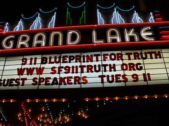
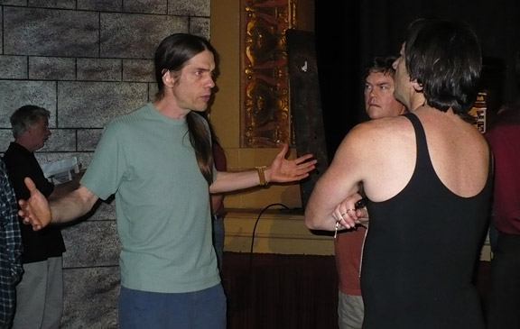
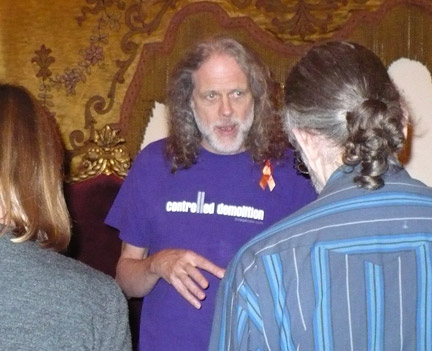
The highlight of the two day event was the presentation "9/11: Blueprint for Truth — 130 Architects and Engineers Examine the Evidence," by architect Richard Gage, AIA, a 20-year architect who worked on numerous steel-framed buildings, who makes a strong case that the buildings were brought down with controlled demolition.
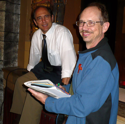
Grand Lake Theater owner and long-time community activist Allen Michaan, introduced Gage and spoke about why 9/11 was the key issue to stop the war. "911 truth is the achilles heel of the administration and when the truth eventually emerges into the mainstream news as is slowly happening these criminals will quickly be removed from office and face prosecution," said Michaan.
Gage starts his presentation by introducing people to his background as an architect and proceeding to make his case for a need for a new investigation based on the irregular collapses of three World Trade Center buildings, including Building 7, a 47-story high-rise, in a 1:45 min Powerpoint presentation. Some of the evidence Gage presented went into the evidence that a explosive incendiary device called Thermate was used to cut the steel beams of the World Trade Towers, explaining that it gives off key by-products like sulfur and magnesium and would account for the molten iron which burned hot under the twin towers and WTC Building 7 weeks after the attacks.
Gage explained how physics would not account for the virtually free-fall collapse of all three buildings as it violates Newton’s Law of Conservation of Momentum. The prevailing theory by by NIST and FEMA is that the buildings feel down because of weakened trusses due to fire causing "progressive pancake collapse," However, according to Gage, this doesn't explain how the buildings could fall at free-fall speed by taking into account this law. Gage: "through the path of greatest resistance – at free-fall speed — the columns gave no resistance."
Gage also discussed eyewitness testimony of first responders seeing flashes and hearing explosions and presented other incongruities in the official story. "What we need is a new unimpeachable investigation, with supeaona powers, as to what really happened that day," said Gage. "The 9/11 Commission could not be considered an unimpeachable investigation." He encouraged the public get over the fear, talk with friends and colleagues and call their representatives to demand a new investigation.
His conclusion was followed by a rousing standing ovation from the audience and a lengthy Q & A session.
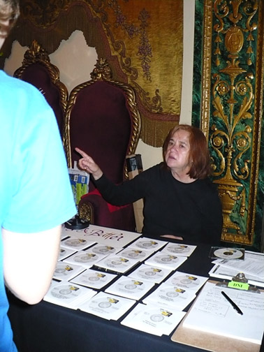
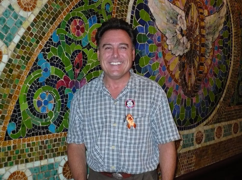
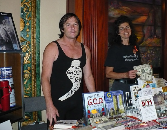
Carol Brouillet, founder of the Northern California 9/11 Truth Alliance, and who was tabling at the event, had this to say about the No. California 9/11 Truth Alliance and Richard's presentation: "People show up, out of the blue, at our meetings and offer us their amazing gifts — journalists, film makers, researchers, professors, artists, musicians, architects. Richard was one of them whose life was transformed by a talk by David Ray Griffin and was inspired to help with his unique architectural background to lend more credibility to the movement. His perseverance, energy, and sheer hard work has helped all of us and casted a larger light on some of the most critical suppressed facts surrounding 9/11. It was a delight to see a full house, knowing how much work Richard, and the many, many others put into promoting, and organizing the Film Festival. it was a tremendous success on multiple levels."
Judy Shelton, an activist and volunteer for the event commented that "the energy was wonderful and there's a sense of something beginning to break around 9/11."
"People who are on the fence about this issue are going to be convinced. It just solidified the facts. The evidence is irrefutable," said Diane Ferchel, a native Californian who is now living in Ecuador.
To hear and read more about Richard Gage and Architects and Engineers for 9/11 Truth visit ae911truth.org. Northern California 9/11 Truth Alliance has meetings bi-monthly, alternating between San Francisco and Oakland. For more details, visit sf911truth.org.

Peas,
Yarrow
it is never to late for the Truth. Keep the faith, spread the word, and never give up. They would like you to think it is hopeless.
That's what Indymedia is all about- each and every one of us who says, "This site should have X information on it!" and then posts it.
Keep on commenting, posting, and reposting (reposting is like if you were to also post this to NYC IMC after you or someone else had posted it here).
by Jim Hoffman
http://www.911research.wtc7.net/essays/pm/index.html
| This is a topic you may find very interesting
and almost unbelievable.
In fact just a few weeks ago during July we saw the same type of Trail over Melbourne. We cannot be sure what it was but I will post the photos up here when I develop the film. The info below was emailed to me but you can access the info direct on the Spotlight site if you wish. I have posted it here for your convenience. Spotlight , by the way is an excellent News Paper in the USA. News you don't get in the main stream. |
PLEASE BOOKMARK THIS SITE!!!
NEW INFORMATION BEING ADDED AS IT BECOMES AVAILABLE!!!
![]() •
SpotlightUpdate
— Successor American
Free Press now in publication
•
SpotlightUpdate
— Successor American
Free Press now in publication
On This Page
• Military Behind Mystery Chemtrails — EXUSIVE TO THE SPOTLIGHT By Mike Blair
• Jet Trails Tested in Combat Scenarios — EXCLUSIVE TO THE SPOTLIGHT By Mike Blair
 A
MUST LISTEN!!!
A
MUST LISTEN!!!
The
Power Hour Radio Show
with Joyce
Riley and Dave vonKleist
hosting Mike
Blair on Friday, July 6th, 2001,
on the Genesis
Communication radio Network.
“We will not
stop!”
— Joyce Riley
and Dave vonKleist

Listening
Options and Stations
CHEMTRAILS OVER AMERICA
A SPECIAL REPORT
June 5, 2001
Researchers assigned to this project have diverse backgrounds and are trained in and associated with a variety of disciplines including electronics, communications and environmental engineering, general medicine, biomedical research, chemistry, government/political, NSA/CIA, and military theory and technology. A team of organized and dedicated professionals has devoted thousands of hours to this project over the past year, and read hundreds of scientific, government and military documents found in the public domain. Individual researchers have conducted in-depth investigation by other means, including direct observation and inquiry.
OVERVIEW
We will talk about four activeprojects
ongoing in the atmosphere across America now.
The first project is designed to block and reduce the radiation from the sun to the earth with an aerosol emitted from aircraft. The aerosol is probably aluminum oxide or a compound that would have similar properties.
We will simply state here that there is a major upper level ozone crisis building without a permanent solution. Please click on the word ozone for a review of the ozone matter. Concerns are widespread and encompass all solar radiation including UV and solar flares. We cannot emphasize enough the serious nature of the ozone depletion to all aspects of life on this planet. Solar radiation can support disease in different forms and directly or indirectly damage the food supplies. UV rays can suppress the human immune system leaving the body vulnerable to many diseases caused by bacteria and viruses entering through or affecting the skin. We do not believe the cause for the ozone depletion has been addressed.
The
typical ozone layer is 1/8 of an inch thick above the earth, the thickness
of two pennies. In space, it's best not to envision the ozone layer as
a distinct, measurable band. Instead, think of it in terms of parts per
million concentrations in the stratosphere (the layer six to 30 miles above
the Earth's surface).
The second and most secretive project is the United States Navy’s RFMP, Radio Frequency Mission Planner, military program. The RFMP is the system name given to a group of computer programs. One of the supporting subprograms within the RFMP system is called the VTRPE computer program. VTRPE is an acronym that stands for Variable Terrain Radio Parabolic Equation. It is a computer Radio Frequency propagation program that deals with radio waves and enables the RFMP system to visually see the battlefield terrain in 3 dimensions (3-D) on a television screen. The RFMP system also depends on satellites to feed their images of the battlefield into it, to then be combined with the battlefield picture painted from the ground, thus producing 3-D images.

Radio Frequency Mission Planner
By providing an extremely interactive and visual (television type radar screens) environment, the RFMP system allows the computer operator to develop familiarity with the “Radio Frequency” environment before a battlefield war mission occurs by playing a variety of “what-if” virtual warfare scenarios on his computer screen. Since all major modes of Radio Frequency propagation are modeled in his computer (RFMP system), special, sometimes counter-intuitive cases can be examined in detail and exploited during a warfare battle mission.
The VTRPE computer program only worked accurately over water and along coastal areas, but not over land masses because the system's radar waves required an atmospheric condition known as “ducting” to operate accurately.

Radar display without
“ducting”

Radar display with
“ducting”
The government and military solved the “ducting” problem by releasing an aerosol, a mixture of barium salts into the atmosphere over America. They made an atmospheric RF duct with a base of barium aerosol from aircraft. The chemical and electrical characteristics of the mixture will cause water moisture to stay in clouds. Again, the aerosol sets up an electrical and chemical environment that supports RF ducting for the RFMP / VTRPE warfare system. Fibers with barium may support ducting. The mixture of barium salt aerosol, when sprayed in a straight line, will also provide a ducting path from point A to point B and will enable high frequency communications along that path, even over the curvature of the earth, in both directions. Enemy high frequency communications can be monitored easier with the straight line A to B ducting medium.

Barium salt chemtrails were
used to support the Navy’s
Radio Frequency Mission Planner
over Iraq and Saudi Arabia.
The third project also utilizes the mixture of barium salts in the atmosphere. Weather control is a project of the U.S. Air Force and utilizes Nikola Tesla concepts of radio frequency radiation (HAARP) against the ionosphere above the earth and to control the jet stream. Fragile life support systems in our environment are being manipulated, tested, and altered by government for military advantage. Air Force documents implied, “the risks are high but the rewards are worth it.” The mixture of barium salts, supporting moisture, is encouraged along the weather fronts and manipulated in a control fashion. It is believed microwave energy is also utilized in the weather control program. Weather data is also a required input to the VTRPE program of the RFMP system.
In the broadest sense, weather-control can be divided into two major categories: suppression and intensification of weather patterns. In extreme cases, it might involve the creation of completely new weather patterns, attenuation or control of severe storms, or even alteration of global climate on a far-reaching and/or long-lasting scale. In the mildest and least controversial cases it may consist of inducing or suppressing precipitation, clouds, or fog for short times over a region. Other low-intensity applications might include the alteration and/or use of near space as a medium to enhance communications, disrupt active or passive sensing, or other purposes. The primary areas include generation and dissipation of precipitation, clouds, and fog; modification of localized storm systems; and the use of the ionosphere and near space for space control and communications dominance.

It appears
the Jet stream has been controlled.

Perfected
weather control technology will enable a military to withhold rain, cause
floods, cause drought, cause storms, withhold sunshine, damage food crops,
and bring any country to its knees without firing a shot.
The fourth project in the atmosphere is the DARPA, Defense Advanced Research Projects Agency, biological detection and decontamination programs. The program also utilizes the mixture of barium salts as the base vehicle in aerosol along with special polymer fibers in the atmosphere. They have released biologicals into the atmosphere in trials, testing the detection and decontamination systems. BCTP oily - water liquid aerosol is considered a biological decontaminate.
It is believed that barium salt, polymer fibers, and other chemicals in the atmosphere are the physical irritants that are either directly or indirectly responsible for the recent nationwide epidemic increase in cases of nose bleed, asthma, allergies, pneumonia, upper respiratory symptoms, and a noticeable increase in arthritis symptoms, recently reported nationwide. Chemicals illegally sprayed into the atmosphere are producing atmospheric and ground conditions detrimental to human and animal health but favorable to the growth of harmful molds / fungus. These conditions are not conducive to good health. The soluble salts of barium, an earth metal, are toxic in mammalian systems. They are absorbed rapidly from the gastrointestinal tract and are deposited in the muscles, lungs, and bone. No case data is available from the medical community on the long term effects of barium in the human body.
The programs are secret because the Federal EPA and State Environmental Quality Agencies need to “not know” about what the by-products of the metabolites of biological, illegal and harmful agents are. It is for that reason the project has been declared secret from the citizens. It is all illegal under federal and state laws.

Mount
Vernon, Washington, May 22, 2001 08:38 PDT
END OF OVERVIEW
FINDINGS
A mixture of barium salt, aerosol chemical trails are being deliberately discharged into the atmosphere from military and civilian registered aircraft over the continental United States at lower altitudes (compared to the aluminum, ozone effort aerosol at much higher altitudes). Selected commercial airliners have been modified and equipped with specialized aerosol dispersion devices. Aircraft emission of aerosol chemical trails is being consistently reported in several other countries worldwide.


GOVERNMENT BARIUM SALT EXCUSE COMING !!!
Mike Blair interview on Joyce Riley, Dave vonKleist’s, The Power Hour, July 6, 2001
“They (government) are already preparing us for the day when it’s going to become widely, universally known that barium salts are being dumped into the atmosphere, they already have an answer for that. They built up a lot of bogus material regarding emissions from coal fired power plants. Would you believe that material, and I have documents to back this up, indicates that the emission from these coal fired plants is barium salt. Could you believe that barium salts would be the largest substance that comes from this black smoke that pours out of some coal fired electrical production plants. It’s unbelievable, but already in place as an excuse! And that’s a scoop, because we haven’t said anything about that before.” — Mike Blair, July 6, 2001.* Barium Compounds total 366,978 pounds, Oologah, Oklahoma *
* Barium Compounds total 1,153,537 pounds, Fannin, Texas *
* Barium Compounds total 427,765 pounds, Vernon, Texas *
* Barium Compounds total 941,815 pounds, Gentry, Arkansas *
* Barium Compounds total 921,867 pounds, Hallsville, Texas *
* Barium Compounds total 2,055,265 pounds, Pittsburg, Texas *


TOP SECRET CLASSIFIED PROJECT
This paper
addresses the two main projects ongoing in the atmosphere. One is a sensitive
experimental project and the other is a secret military project. The sensitive
experimental project is a compound aerosol, possibly aluminum, dispersed
at higher altitudes because of the ozone depletion. The main secret
military, chemtrail project is the United States Navy’s, RFMP, Radio
Frequency Mission Planner, and the subprogram, VTRPE, Variable Terrain
Radio Parabolic Equation, computer propagation program. The old VTRPE
subprogram has been updated and “enhanced” to function accurately over
land with the enabler chemical aerosol, a mixture of barium salts in the
atmosphere. The barium salt in the atmosphere acts as the facilitator electrolyte
and allows the high tech., cutting edge advanced electronic systems to
function in a military warfare environment. The VTRPE program would not
accurately function without barium salt facilitating the RF “ducting” over
land. (The RFMP supports the planning, simulation, training, and monitoring
of Radio Frequency-related missions by integrating a wide variety of propagation
models, environmental (weather) databases, and mission analyses.
These missions include:
1. signal detection, detection: 1. The recovery of information from an electrical or electromagnetic signal. Note: Conventional radio waves are usually detected by heterodyning, i.e., coherent reception/detection. In this method of reception/detection, the received signal is mixed, in some type of nonlinear device, with a signal from a local oscillator, to produce an intermediate frequency, i.e., beat frequency, from which the modulating signal is recovered, i.e., detected. The inherent instabilities of available optical sources have, until relatively recently, prevented practical use of coherent reception/detection in optical communication receivers. At present, coherent optical receivers, using sophisticated technology, are just beginning to emerge from the laboratory into the field. Virtually all existing optical receivers employ direct detection; that is, the received optical signal impinges directly onto a detector. Direct detection is less sensitive than coherent detection. [After FAA] 2. In tactical operations, the perception of an object of possible military interest but unconfirmed by recognition. [JP1] 3. In surveillance, the determination and transmission by a surveillance system that an event has occurred. [JP1]
2. acquisition: 1. In satellite communications, the process of locking tracking equipment on a signal from a communications satellite 2. The process of achieving synchronization 3. In servo systems, the process of entering the boundary conditions that will allow the loop to capture the signal and achieve lock-on.
3. geolocation: The mathematical correspondence between image coordinates (line, sample) and geographic coordinates (lat., long.)
4. deconfliction: (DOD) A systematic management procedure to coordinate the use of the electromagnetic spectrum for operations, communications, and intelligence functions. Frequency deconfliction is one element of electromagnetic spectrum management. See also electromagnetic spectrum; electronic warfare; spectrum management.
5.basic communications system planning
6. meaconing: (DOD, NATO) A system of receiving radio beacon signals and rebroadcasting them on the same frequency to confuse navigation. The meaconing stations cause inaccurate bearings to be obtained by aircraft or ground stations. See also beacon.
7. interference, electromagnetic interference (EMI): Any electromagnetic disturbance that interrupts, obstructs, or otherwise degrades or limits the effective performance of electronics/electrical equipment. It can be induced intentionally, as in some forms of electronic warfare, or unintentionally, as a result of spurious emissions and responses, intermodulation products, and the like.
8. jamming, jamming to signal ratio (J/S): The ratio, usually expressed in dB, of the power of a jamming signal to that of a desired signal at a given point such as the antenna terminals of a receiver.
9.intrusion: The act of wrongfully entering upon, seizing, or taking possession of the property of another.
10.detection:
The act of discovering or determining the existence, presence, or fact
of Intrusion Detection; The act of discovering or determining the existence,
presence, or fact of the wrongfully entering upon, seizing, or taking possession
of the property of another. (acronym for 6,7,8,9 is “MIJI”,
they are grouped together.)
By providing an extremely interactive and visual (radar screens) environment, the Radio Frequency Mission Planner, RFMP, allows the computer operator to develop familiarity with the Radio Frequency environment before a mission occurs by playing a variety of “what-if” virtual warfare scenarios on his computer screen. Since all major modes of RF propagation are modeled in his computer, (RFMP system), special, sometimes counter-intuitive, cases can be examined in detail and exploited during a mission. The RFMP can paint a 3-D picture of the battlefield using satellite and ground radar imaging techniques.

Radio Frequency Mission Planner

They have developed and
upgraded a new computerized military virtual
warfare system using barium
salt as an atmospheric ducting medium
to make the VTRPE subprogram
work accurately over land masses.
This system is far reaching
and has great possibilities in warfare.
It is the most sophisticated
coming together of high technical science
warfare in history.
Satellite
involvement as part of the RFMP system
is acknowledged.
Chemtrail aerosol was photographed by satellite over Iraq and Saudi Arabia, NOAA / NESDIS, NOAA-11, during the Gulf War. Also, the polymer fibers in the aerosol barium, in the atmosphere, can be used as an optical detection system to discover the presence of biological agents in the atmosphere.
Barium salt chemtrails were
used to support the Navy’s Radio Frequency
Mission Planner over Iraq
and Saudi Arabia.
The RFMP system is designed to support not only mission planning, but also RF-related mission training and simulation within the DIS community.
Variable Terrain Radio Parabolic Equation (VTRPE) computer program is used within RFMP as a subprogram to predict performance for frequencies between 100 MHz and 20 GHz. VTRPE is dependent on terrain data and will also approximate propagation through ducts over both land and water. VTRPE is a computationally intensive model.

This is a part of the RFMP,
Radio
Frequency Mission Planner.
Notice: “VTRPE propagation
code” square, “weather model” square
The USS Enterprise and her battle group, off the coast of North Carolina, on March 20, 2001, (26,000 men in the fleet and on the coast) were testing and applying the RFMP/VTRPE ship and satellite imaging using the barium salts aerosol.
We know, in this exercise,
they used the RFMP and barium salts and “weather control” to produce a
storm at the time of the exercise. We know this happened because we had
a person there! This event was never reported outside of the coastal
area of North Carolina.
From WCTI-TV 12 News, New Bern, North Carolina
NATO Training at Pamlico Correctional Facility
by Cooper Parham, March 20, 2001PAMLICO COUNTY — It’s a picture few of us ever want to see... military tanks surrounding a local prison, but that’s what happened at Pamlico Correctional Facility. The tanks are part of a NATO join task force exercise for the military. Eastern North Carolina is the enemy territory. More than 26,000 people are participating in this operation. Most of them are hundreds of miles off shore with the USS Enterprise’s battle group. The simulated war is to test satellite and aircraft imagery, as well as to prepare some of the troops for deployment. The exercise will continue throughout the week, all over Eastern North Carolina.
Craven County Floods Due to Nor’easter System
by Kimberly Stewart, March 21, 2001NEW BERN — When you woke up Wednesday morning, you more than likely saw downed tree limbs and flooded driveways. Emergency crews worked throughout the morning cleaning up debris due to high winds (65 mph) and heavy rains. Union Point Park was nearly under water. East Front Street and Oaks Road near the National Cemetery were virtually impassable. In some areas, emergency crews reported up to four feet of flooding. Manholes cracked, causing even more water to spew. One home in Dover was damaged due to a fallen tree.
PROPAGATION MODELS
Analyses within RFMP are performed by accessing computer algorithms that model propagation of signals as they travel away from the transmitting antenna. Some of the algorithms use complex physics and mathematics to calculate the results while others are based on experimental data that has been accumulated over many years. Some of the propagation programs available to the Radio Frequency Mission Planner are:
Damboldt: Damboldt is a high-frequency (HF) skywave model used to analyze signals that are refracted off the ionosphere. Damboldt is considered valid for frequencies between 2 MHz and 50 MHz, and does not require many sample points in VOI. Damboldt is terrain-independent and can be applied over land and/or water. HF skywaves may be detected under the right conditions at distances exceeding several thousand miles.
GRWAVE: The ground wave model GRWAVE is independent of terrain and is used to predict HF LOS propagation for frequencies between 2 MHz and 50 MHz. HF ground waves are not likely to be detected beyond 100 miles, although HF skywaves may be detected at ranges exceeding 1000 miles.
TIREM: The Terrain Integrated Rough Earth Model (TIREM) incorporates terrain effects and is applicable from 2 MHz to 20 GHz. TIREM also returns a mode parameter to indicate whether the strongest signal is LOS, diffracted, or troposcatter.
FFACTR: FFACTR is recommended for frequencies above 100 MHz and below 20 GHz for paths only over water. The FFACTR model (F Propagation Factor) is not an acronym, but a variable name within the EREPS program.
RPO: Radio Physical Optics (RPO) is applied in the same situations as FFACTR. RPO uses different techniques and may produce better results if ducts are present. As one of the early users of RFMP, we can only recommend that you gain experience with FFACTR and RPO and reach some conclusion as to which one produces better results for your operating environment.
VTRPE:
Variable Terrain Radio Parabolic Equation (VTRPE) is used within RFMP to
predict performance for frequencies between 100 MHz and 20 GHz. VTRPE is
dependent on terrain data and will also approximate propagation through
ducts over both land and water. VTRPE is a computationally intensive model
and VTRPE analyses may take longer than analyses with other models. The
new enhanced VTRPE model functions over land with barium salt in the atmosphere
as the facilitating medium to generate ground radar imaging and satellite
imaging data, converted to television display images.
Examples of two propagation slices generated against the San Diego scene are shown, one for clear day atmospherics — (http://www.photon.com/About%20Photon%20Research/Corp%20&%20Divisons/Port%20Jefferson/Radar%20Systems/rdrscegen/vtrpe/clearday/clearday.htm), and the other representing ducting conditions — (http://www.photon.com/About%20Photon%20Research/Corp%20&%20Divisons/Port%20Jefferson/Radar%20Systems/rdrscegen/vtrpe/ducting/ducting.htm), based on measured refractivity profiles, resulting in significant focussing of radar power in certain overland regions, and creating significant gaps in radar coverage near land.

Clear day atmospherics

Ducting conditions
MILITARY PROJECTS AND EXPERIMENTS
Military
projects are associated through the mixture of barium salt in the lower
atmosphere. The main purpose of the mixture of barium salt aerosol in the
atmosphere is for the functioning of the most secretive project, the refinement
and operation of the Radio Frequency mission Planner/Variable Terrain Refractivity
Parabolic Equation, RFMP/VTRPE, computer propagation program for the United
States Navy. Weather control also utilizes barium salt in the atmosphere
to accomplish its goals. The projects are under the heading and associated
with the term Advanced Radar Studies.
A MIXTURE OF BARIUM SALT IS THE ATMOSPHERIC MEDIUM THAT CAUSES RF “DUCTING”
Barium salt
“chemtrails” can be used to create an artificial ducting path at altitudes
needed for communications from the command and control area to the battlefield
operations area. Radio waves (voice, data and radar) follow this artificial
path in both directions for a maximized communications path. Barium salt
is the atmospheric medium used with the enhanced Variable Terrain Refractivity
Parabolic Equation (VTRPE) propagation program, part of the Radio Frequency
Mission Planner (RFMP.) Weather information (environmental input data)
is fed to the “weather model” computer program, connected to the VTRPE
computer propagation model program. Barium salt is an atmospheric medium
used for both the HAARP associated RF, weather control and
RFMP/VTRPE propagation programs.
ILLEGAL UNDER UNITED STATES REGULATIONS AND LAWS
The program
is classified because the Federal EPA and State Environmental Quality Agencies
need to “not know” about what the by-products of the metabolites
of biological, illegal and harmful agents are. It is for that reason the
project has been declared secret from the citizens.
RFMP / INTERACTIVE DATAWALL

The increasingly complex battlefield
environment drives the requirement for the presentation and interactive
control of an endless stream of information arriving from a diverse collection
of sensors deployed on a variety of platforms. At best, the situational
awareness picture is fragmented without the benefit of extensive data fusion
and correlation to present a true picture of the battlespace from all information
sources. Collaboration and interaction is also needed for operators within
a control center and among remote geographic locations. The need to display
and manipulate real-time multimedia data in a battlefield operations control
center is critical to the Joint Commander directing air, land, naval and
space assets.
AFRL/IF has successfully implemented a number of Interactive DataWalls each consisting of three horizontally tiled video projectors. They include SGI-based and Sun-based configurations. They all have the same wireless interaction capabilities.
To support the testbed for the forward deployable element of the Configurable Aerospace Command and Control (CACC) Integrated Technology Thrust Program (ITTP), a Sun workstation based Deployable Interactive DataWall (DID) with a 9' x 2 1/4' screen was developed. It is housed in an extensively modified Air Force S-530 A/G Standard Rigid Walled shelter, with its own Tactical Generator Set and Environmental Control Unit. Due to the unique, short-throw, rear-projection requirements, three LCD projectors with special short-throw lenses are used.
Near term plans for the Interactive DataWall include testbed installations at the ACC Command and Control Battlelab located at Hurlburt Field, FL and the AFRL Human Effectiveness Directorate (HE) at Wright-Patterson AFB, OH. Multiple copies of the laser pointer tracking hardware are being built to support both current and future DataWall installations.
Future research plans for the Interactive DataWall technology include the incorporation of a magnetic position tracking system to replace the laser pointer tracking. This will simplify the configuration by eliminating the video cameras and potentially allow multiple simultaneous pointers. Multiple user speech input is being investigated for the possibility of simultaneous speech activation by different DataWall operators. Collaboration of data and operator interactions at physically separated DataWall command centers is also being researched.
A PC-based Interactive DataWall is being investigated as a low-cost alternative to Unix workstation-based systems that have been developed. A transportable version of the DataWall is also being researched that can be disassembled, transported, and reassembled in a short period of time for indoor use.

Deployable
Interactive DataWall
Specifications:
| Hardware: | Software: |
| SGI Interactive DataWall: | Nuance Continuous Speech Recognition (Nuance) |
| SGI Onyx Workstation w/ 3 Reality Engines | X-META-X (X-Software) |
| ([1280 x 3] x 1024 pixels) | Laser Pointer Tracking Software (AFRL/IF) |
| SGI Indy Desktop Workstation (for speech recognition) | Tiled Display Alignment Software (AFRL/IF) |
| Sun Interactive DataWall: | |
| 1 Sun Ultra 60 SPARC Workstation | System Availability: |
| 2 Sun Ultra 30 SPARC Workstations | |
| ([1280 x 3] x 1024 pixels) | The SGI and Sun Interactive DataWalls are |
| located in the Command & Control Technology | |
| Deployable Interactive DataWall: | Center, Rome NY |
| Sun Ultra Enterprise 3500 Server | |
| ([1024 x 3] x 768 pixels) | |
| . | |
| All Systems: | |
| 3 Video Cameras | . |
| 3 Video Projectors | . |
| Rear Projection Screen | . |
| Wireless Microphone | . |
| Laser Pointer | . |
| Laser Pointer Tracking Hardware (AFRL/IF) | . |
OZONE LAYER (TROPOSPHERIC AND STRATOSPHERIC)
There is great concern among the scientific community that the ozone layer has been very seriously damaged. We believe the reason for the damage has not yet been mentioned or addressed. Ongoing study of this problem by individual researchers is eliciting concrete evidence that, at the very least, the atmospheric chemistry and circulation of the earth’s atmosphere have been disrupted. There is a growing body of evidence to justify concern that there are serious problems with our atmospheric chemistry and our protective ozone layer above the earth. There is growing evidence that aerosol aluminum compounds are being systematically released at higher altitudes above 30,000 feet, and is directly related to the ozone problem. There is growing evidence that instances of ultra violet radiation caused skin cancer will increase. The consequences are sobering to consider. Aluminum compound is being discharged by aircraft at higher altitudes, in a separate project, for filtering and reflecting radiation, including ultra violet, from the sun. Polymer fibers are being found in various locations subsequent to observed incidence of aerosol discharge by subsonic aircraft. Research and development of polymer fibers is identified and described in Defense Advanced Research Projects Agency, DARPA, documents. Other polymer fiber types are mentioned in other government and military documents.
 Click on image and journey to originating web page
Polymer fibers

It is believed that barium salt, polymer fibers, and other chemicals in the atmosphere are the chemicals and physical irritants that are either directly or indirectly responsible, for the recent nationwide epidemic increase in cases of nose bleed, asthma, allergies, and upper respiratory symptoms including pneumonia. Chemicals illegally sprayed into the atmosphere are producing atmospheric and ground conditions detrimental to human and animal health but favorable to the growth of harmful molds and fungus. These conditions are not conducive to good health. The soluble salts of b
The answer to that query would explain the illegal wire-taps, suspension of habeas corpus, banning of books like "America Deceived" from Amazon, detaining of dissenters in fences miles away from events, and multiple wars based on lies.
How can the gov't be innocent in 9/11 when we have caught it lying so many times (WACO, Ruby Ridge, no WMDs, USS Liberty, Operation Northwoods, Gulf of Tonkin, Pearl Harbor, ETC.)?
In law, if you determine a person lies ONCE during his testimony, it can be assumed that he lied in the remainder of his testimony. How come we do not hold the gov't to the same standard as it holds us to?
The gov't lied to us about Iraq and more Americans have died there than in 9/11. If the gov't lied about Iraq then why is everyone so reluctant to believe that the gov't lied about 9/11?
Final link (before Google Books bends to pressure and drops the title):
<a>America Deceived (book)
Donate

$120.00 donated
in the past month
Get Involved
If you'd like to help with maintaining or developing the website, contact us.
Publish
Publish your stories and upcoming events on Indybay.